Jacob de Gheyn (II): Map of The Hague (1598)
(Rijksmuseum, Amsterdam, The Netherlands)
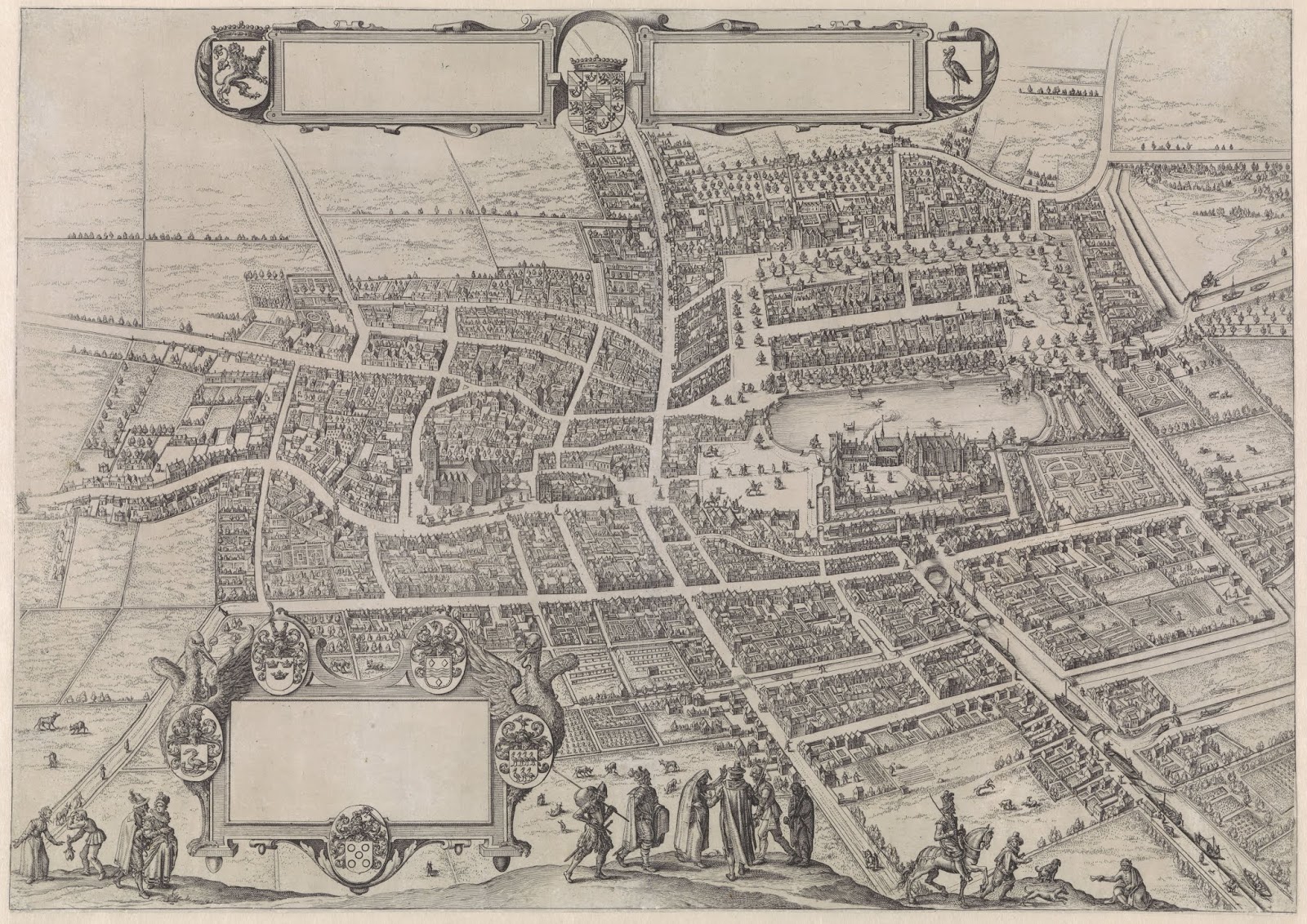
An engraving by the Dutch artist Jacob de Gheyn (II) (1565-1629). This print offers a bird's-eye view of the Dutch city of The Hague. Although people had lived in the region of the Hague since Roman times, the city itself thanks its foundation to the counts of Holland. Count Floris IV of Holland (1210-1234) purchased a residence in the region which his sons William II had rebuild into a proper court. The son of William II, count Floris V (1254-1296) finished the construction which was called 'the Binnenhof' ("Inner Court"). It was build near a small lake called the 'hofvijver' the counts used it as their administrative residence. Around the binnenhof a village was started which evolved into The Hague. On the map the binnenhof can be seen on the right next to the lake. After the time of the counts of Holland the Binnehof became the political centre of the Dutch Republic in 1584 and it is this used as the bicameral legislature of the Netherlands - it is the oldest House of Parliament in the world still in use. In 1598 the Hague was still fairly small as is had about 10,000 inhabitants.(today it is the third-largest city in the Netherlands with a metropolitan population of more than 1 million). Engraving from 1598.