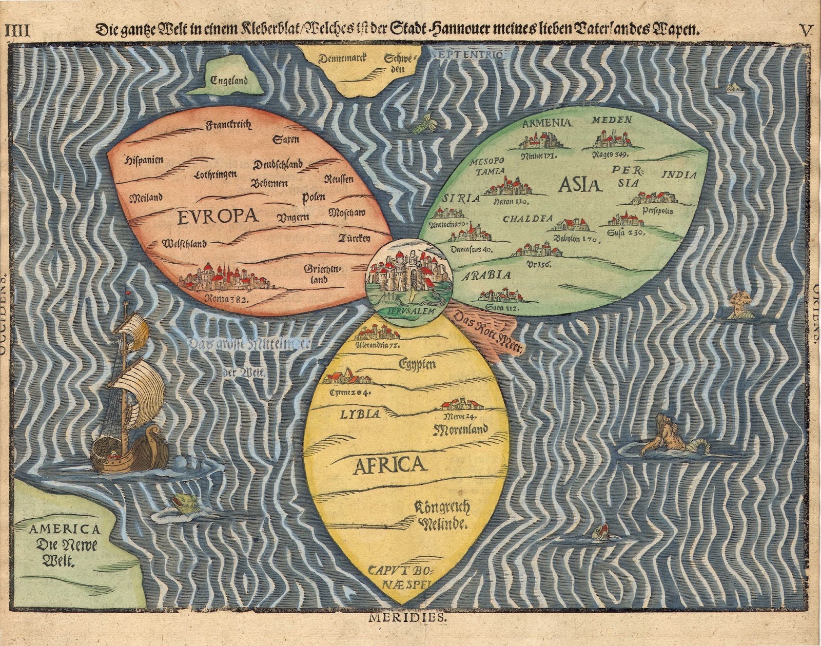
Heinrich Bünting: Clover Leaf Map (1581)
(Yale University Library, New Haven,USA)
A woodblock made by the German pastor and theologian Heinrich Bünting (1545 – 1606). This print comes from the book "Itinerarium Sacrae Scripturae" (Travel book through Holy Scripture). The book is a collection of woodcut maps of the Holy land but also contains three figurative maps; the world depicted using a cloverleaf design, Europe in the form of a queen, and Asia as the winged horse Pegasus. In this curious map, the world is divided into three continents: Europe (red), Asia (green) and Africa (yellow). England is shown as an island above Europe, the southern part of Scandinavia is shown top centre and the recently discovered America is shown in the bottom left corner ('America - The New World'). in the centre of the world is Jerusalem with the red sea. This symbolical map is a variation of the T-O world map model (see this link for an example: Hanns Rüst - Map of the World (1480)) and it is thought to possibly represent the Holy Trinity. Map from 1581.
